


The Spanish Pyrenees stretch over 400 kilometres along the border with France, but for a first visit it helps to think of them not as a single wall of mountains, but as three distinct regions: the Navarrese, Aragonese and Catalan Pyrenees. Each offers different landscapes, access routes, activities and styles of village life. This guide focuses on helping you understand that geography so you can choose a base that matches your plans for hiking, snow sports or simply slow travel in the mountains.
Understanding the Spanish Side of the Pyrenees
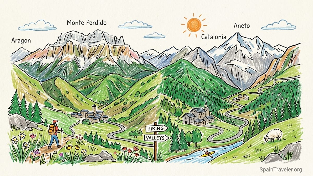
The Pyrenees form a natural border between Spain and France, running from the Atlantic near the Bay of Biscay to the Mediterranean. On the Spanish side they cut across three main regions that matter for travelers: Navarre in the west, Aragon in the centre and Catalonia in the east. Within these ranges lie more than 200 summits above 3,000 metres, including famous peaks such as Aneto at about 3,404 metres, Monte Perdido, Posets and Pica d’Estats. In practice, the highest and most alpine terrain concentrates in the central Aragonese section and the central eastern Catalan section, while the western Navarrese side is greener and lower but deeply carved by valleys.
Instead of one continuous resort strip, the Spanish Pyrenees are a patchwork of valleys. Each valley has its own road access, main town and set of side valleys where trailheads, ski lifts and rafting bases are found. For example, Benasque is the gateway to the Aneto and Posets massifs in Aragon, while Vielha anchors the Val d’Aran in Catalonia. Once you are in a valley, it can take several hours of slow, twisting driving to reach the next one, even if they look close on the map. This makes choosing the right base especially important for a first-time trip.
Altitude also varies by region. The Navarrese Pyrenees rarely reach the 3,000 metre line, with rounded ridges and extensive beech and fir forests. The Aragonese Pyrenees contain the highest concentration of three-thousanders, including Aneto, Posets and Monte Perdido, and valleys like Tena, Ordesa and Benasque are ringed with sharp peaks and high cirques. The Catalan Pyrenees are more broken up, with distinct subregions like the Val d’Aran, Aigüestortes i Estany de Sant Maurici National Park and the wide Cerdanya basin, where some summits such as Pica d’Estats reach above 3,000 metres.
For international visitors, it helps to picture a west to east progression. From Pamplona you reach the green Navarrese valleys and Roncal. From Zaragoza you drive north into Aragon and the classic high-mountain landscapes of Jaca, the Tena Valley, Ordesa and Benasque. From Barcelona and Toulouse your logical targets are the Catalan valleys: Cerdanya, Aigüestortes and the Val d’Aran. Where you land and how much time you have will shape which of these regional slices makes the most sense.
Navarrese Pyrenees: Isaba and the Roncal Valley
The Navarrese Pyrenees occupy the western end of the Spanish range. They are closer to the Atlantic, so the climate is damper and the mountains are more rounded, with dense beech and oak forests and high pastures. Peaks are generally below 2,500 metres, but the valleys feel enclosed and remote, especially around the Roncal and Salazar valleys. This is the quietest and least developed section for mass tourism, yet for many walkers it is the most atmospheric introduction to Pyrenean village life.
Isaba, in the Roncal Valley, is a good example of what to expect. It is a compact stone village of slate roofs and narrow lanes, with a handful of small hotels and rural guesthouses. In summer, hikers use it as a base for day walks toward the Belagua valley and the limestone plateau near the French border. Expect to pay roughly the price of a mid-range Spanish city hotel for a double room in high season, but in return you can walk out of town and be on quiet trails within half an hour, often without seeing many other visitors once you leave the main routes.
Activities here are quieter and more nature-focused than in the central Pyrenees. Summer is about hiking through beech forests, spotting vultures along the valley walls and visiting lookout points such as the Belagua area. There is some canyoning and river activity in nearby gorges, usually offered by small local operators, but you will not find large ski complexes or big rafting bases. Winter brings cross-country skiing to Belagua and snowshoe itineraries from high roadheads, but downhill skiing infrastructure is limited compared with Aragon and Catalonia.
For access, Pamplona is the main gateway city, with a small airport and rail connections from Madrid and Barcelona. From Pamplona it is typically a two hour drive to Isaba via winding two-lane roads, and having a rental car is almost essential for exploring side valleys. If you are flying into Bilbao or San Sebastián and combining the Basque coast with a short mountain stay, the Roncal area can be reached in around three hours by car, making it a feasible add-on rather than a standalone mountain holiday.
Aragonese Pyrenees: Jaca, Tena Valley, Ordesa and Benasque
The Aragonese Pyrenees form the high central spine of the range in Spain and concentrate many of its most iconic landscapes. The region’s mountain area spans several counties such as La Jacetania, Alto Gállego, Sobrarbe and Ribagorza, with altitudes that often exceed 3,000 metres. This is where you find classic postcards of rocky cirques, hanging valleys and glacial lakes, as well as some of Spain’s best-known ski resorts. For first-time visitors who want a strong sense of big mountains, Aragon is often the safest choice.
Jaca is the traditional hub at the western end of the Aragonese Pyrenees. It sits in the Aragón valley and acts as a crossroads for roads leading to the Somport Pass, the Tena Valley and the western entrance to Ordesa. As a town of around 13,000 people, it has full services: supermarkets, sports shops, equipment rental and a wide range of hotels, from simple pensions to modern four-star properties. In winter many Spanish visitors base themselves in Jaca and drive to nearby ski areas such as Astún and Candanchú, about 30 minutes away. In summer, Jaca works as a lower-altitude base with more nightlife and better transport links.
North of Jaca, the Tena Valley offers a more contained mountain setting. The valley is threaded by the Gállego River and ringed by peaks that exceed 3,000 metres, including Balaitús, Gran Facha and the Picos del Infierno. Villages such as Sallent de Gállego and Panticosa serve as summer hiking bases and winter access points to ski areas. In summer you can take cable cars from Panticosa or nearby Formigal to reach high trails and alpine lakes within a short walk. Prices for lift tickets are typically lower than in major Alpine resorts, and a mid-range hotel in Sallent often comes in below what you would pay in the French Alps for a similar standard.
Further east, Ordesa and the town of Aínsa mark one of the key transitions in the Aragonese Pyrenees. Ordesa y Monte Perdido National Park protects several deep glacial canyons, of which Ordesa and Añisclo are the most visited. The classic walk from the Pradera de Ordesa to the Cola de Caballo waterfall is a full-day hike that gains more than 600 metres of elevation on good paths and is doable by fit first-timers. Aínsa, roughly an hour south of the park’s main entrances, is a medieval hill town that has repositioned itself as a base for both hiking and mountain biking, with a growing network of trails and a historic stone plaza with boutique hotels and restaurants.
At the eastern end of Aragon, the Benasque Valley provides access to the highest concentration of three-thousand-metre peaks in the range, including Aneto and Posets. The town of Benasque itself combines old stone streets with more modern apartment blocks and hotels and has become an important hub for both summer mountaineering and winter skiing. Just above, the small purpose-built village of Cerler hosts the area’s main downhill ski resort, which is one of the highest in Aragon. In summer, shuttle buses run up the valley to trailheads such as Besurta and Llanos del Hospital, from where paths lead toward the Forau d’Aigualluts, Aneto and cross-border passes.
Reaching the Aragonese Pyrenees usually involves flying into Zaragoza or Barcelona and continuing by road. Zaragoza is around 150 to 200 kilometres from the mountain valleys, depending on your destination. For example, typical driving times are about two and a half hours from Zaragoza to Benasque and roughly two hours from Zaragoza to Jaca in normal conditions. From Barcelona, expect a four to five hour drive to Benasque or Ordesa. Public transport exists, usually through regional bus companies connecting Zaragoza or Barcelona with towns like Jaca, Aínsa and Benasque, but services are less frequent than in lowland Spain, so many visitors choose to rent a car for flexibility.
Catalan Pyrenees: Val d’Aran, Aigüestortes and Cerdanya
The Catalan Pyrenees stretch from the central massif eastward toward the Mediterranean and are divided into several distinct valleys. For most international visitors the three names that matter are the Val d’Aran, Aigüestortes i Estany de Sant Maurici National Park and Cerdanya. Each offers a different mix of skiing, summer hiking and village life, with access options from both Barcelona and Toulouse. Peaks in this section include Pica d’Estats, which rises above 3,100 metres, and numerous 2,800 to 3,000 metre summits scattered around Aigüestortes and the frontier ridges.
The Val d’Aran is a high, north-facing valley whose rivers drain toward France and the Atlantic rather than toward the rest of Spain. Its main town, Vielha, sits on the floor of the valley, linked to the south by a long road tunnel through the watershed. Higher up the valley, villages like Arties and Salardú provide access to Baqueira Beret, Spain’s most prominent ski area by reputation and lift capacity. In winter, Baqueira attracts a mix of Spanish and international skiers, many of whom fly into Barcelona or Toulouse and take a transfer of around two and a half to four hours to reach the valley. Summer brings hikers and trail runners drawn to a network of routes that link glacial cirques and mountain refuges.
On the southern side of the watershed, the Aigüestortes i Estany de Sant Maurici National Park protects a classic high-mountain landscape of granite peaks and more than 200 lakes. Access is mainly through valley towns such as Boí and Espot, where visitors switch to park shuttle vans in high season to reach trailheads at Aigüestortes and around Lake Sant Maurici. Day walks range from gentle lakeside circuits suitable for families to demanding full-day hikes that cross passes above 2,500 metres. Mountain refuges around sectors such as Colomers allow multi-day trekking circuits that dip in and out of the national park boundaries and sometimes connect with the Val d’Aran.
Further east, Cerdanya offers a broader valley floor and a more open feeling than most of the Pyrenees. The valley is shared between Spain and France, with towns like Puigcerdà on the Spanish side and Bourg-Madame just across the border. Because of its orientation and relatively gentle slopes, Cerdanya has become a year-round destination for residents of Barcelona seeking second homes, with several mid-sized ski areas on the surrounding hills and an extensive network of walking and cycling routes. The wide valley floor means that villages are more spread out and the landscape less sheer than in Aran or Benasque, which might suit travellers who want easier driving and more space between climbs.
Access to the Catalan Pyrenees is generally simpler than to Aragon if you are starting in Barcelona. High-speed trains run from Barcelona to Lleida, from where buses and transfers fan out to the Val d’Aran via the Vielha tunnel. Driving times from Barcelona airport to Vielha are typically around four hours, slightly less in light traffic. To reach Cerdanya, drivers often take the direct road north toward the Túnel del Cadí and continue to Puigcerdà, with a driving time in the range of two and a half hours. From France, Toulouse airport is a common entry point for the Val d’Aran and some eastern valleys, with road distances to Vielha of about 170 kilometres via mountain passes or tunnels, depending on conditions.
Summer: Hiking, Rafting, Canyoning and Mountain Villages
Summer is when the geography of the Spanish Pyrenees matters most for planning. Each major valley offers its own network of day hikes, longer treks and river activities, but distances between valleys can be deceptive. A visitor based in Jaca who wants to walk the classic Ordesa valley route, for example, will face a drive of about two hours each way, so it is usually wiser to move bases rather than commute daily across the range. As a rule of thumb, choose one or two neighbouring valleys per week of travel rather than trying to crisscross from Navarre to Catalonia.
Hikers will find well-marked paths in every region. In the Aragonese Pyrenees, signposted routes in Tena, Ordesa and Benasque reach glacial lakes, high passes and viewpoints. In Tena, for instance, cable cars from Panticosa can cut hours of ascent, placing you close to lakes like the Ibones Azules beneath the Picos del Infierno. In Benasque, the popular walk to the Forau d’Aigualluts provides close views of Aneto’s massif without requiring glacier travel. In the Catalan Pyrenees, Aigüestortes and Val d’Aran offer circuits that link tarns and granite ridges, often starting from shuttle drop-off points to limit private car access.
Water sports are concentrated in certain valleys. Rafting and hydrospeed are common on the Ésera River near Campo and Benasque and on sections of the Noguera Pallaresa in Catalonia, which flows through towns like Sort and Llavorsí. Canyoning is especially developed around the Ordesa area and in some side canyons of the Sierra de Guara further south, where local guides provide neoprene suits, helmets and harnesses for half or full-day descents. Prices for guided rafting and canyoning trips are typically competitive compared with Alpine countries, often costing what you might pay for a mid-range restaurant dinner in a Spanish city, but it is important to book with licensed companies and check that guides are certified.
Village life changes from valley to valley. In the Navarrese Roncal and Salazar valleys you will find small stone hamlets with a few guesthouses and traditional eateries focusing on lamb, cheese and mountain stews. In Aragon, Jaca and Aínsa offer more urban comforts and evening promenades, while villages like Sallent de Gállego or Benasque blend old cores with modern hotels and outdoor gear shops. In the Catalan Pyrenees, Vielha, Arties and Boí are geared toward both summer walkers and winter skiers, with a mix of family-run boarding houses and apartment hotels. In Cerdanya, Puigcerdà and the surrounding villages feel more like a rural hinterland of Barcelona, with supermarkets, bakeries and a large number of second homes.
Weather in summer can vary widely. Lower valleys can feel hot in July and August, with afternoon thunderstorms building over the peaks. Many walkers plan early starts, aiming to be back below exposed ridges by mid-afternoon. At higher elevations, nights are cool even in mid-summer, and some passes still hold old snowfields into June. For first timers, this means packing layers and waterproofs even if you never plan to set foot on a glacier, and being flexible: a forecast of storms in Ordesa might encourage you to spend that day exploring the historic quarter of Aínsa or taking a shorter forest walk in the Roncal area.
Winter: Skiing and Snow Activities Across the Regions
In winter the most obvious dividing line in the Spanish Pyrenees is between serious downhill ski areas and quieter valleys focused on cross-country skiing or snowshoeing. The largest downhill complex is Baqueira Beret in the Val d’Aran, followed by Aragonese resorts such as Formigal and Cerler and several mid-sized Catalan and Navarrese hills. Plenty of visitors combine skiing with off-slope days exploring old villages, hot springs or short valley walks where snow cover allows.
For downhill skiing, international visitors most often target Baqueira Beret and the Aragonese resorts. Baqueira typically opens from late November or early December to early April, conditions permitting, with modern lifts and a substantial vertical drop. Access from Barcelona or Toulouse is straightforward via well-maintained roads, though snow chains or winter tyres can be advisable during storms. In Aragon, Formigal and Panticosa in the Tena Valley, along with Astún and Candanchú near Jaca, cater primarily to Spanish skiers but increasingly welcome international guests. Further east, Cerler above Benasque offers long runs on high, north-facing slopes.
Cross-country skiing and snowshoeing are more common in the quieter valleys. The Belagua area above the Roncal Valley in Navarre sets out groomed cross-country trails when snow cover allows, with basic rental facilities and mountain refuges. Around Benasque, the Llanos del Hospital area offers both Nordic trails and snowshoe routes, with a mountain hotel and access protected by a shuttle system at busy times. In the Catalan Pyrenees, several small Nordic centres operate in forested plateaus, and snowshoe circuits are marked near Aigüestortes and some Cerdanya plateaus. Snow conditions can be variable, especially at lower elevations, so it is best to check recent reports and to remain flexible about which valley you visit on a given day.
Costs for lift passes remain generally lower than in the Alps, though high-season weekends and holiday periods bring premium pricing. Equipment hire is widely available in resort villages and larger hubs like Jaca, Vielha and Benasque. Many international visitors choose to rent a car at the airport to retain the option of moving between resorts depending on snow conditions; for example, a skier staying in Jaca can choose between Astún, Candanchú and Formigal within roughly an hour’s drive in different directions, spreading the risk of poor weather in any single area.
Driving in winter requires more preparation than in summer. Mountain roads can be snowy and occasionally subject to avalanche control closures, particularly on approaches to high passes. Major access routes such as the N-230 to Val d’Aran and the A-136 to Formigal are kept open as priorities, but drivers should carry snow chains where required and build extra time into their plans. For visitors who prefer not to drive, many resorts are served by ski buses from nearby towns, and some hotels in hubs like Vielha, Jaca or Benasque arrange private transfers to the lifts, though this adds to the overall cost of the trip.
Getting There, Getting Around and Choosing Your Base
Most international visitors enter the Spanish Pyrenees via four main cities: Barcelona and Girona on the Mediterranean side, Zaragoza in the Ebro valley and Toulouse on the French side. Barcelona has the widest range of long-haul and European flight connections and is the default arrival point for many travelers heading to Catalan valleys such as Cerdanya, Aigüestortes and Val d’Aran. From Barcelona, high-speed trains run inland to hubs like Lleida and Girona, from which regional buses and rental cars continue north toward the mountains. Toulouse airport serves the French Pyrenees but is also a popular entry point for the Val d’Aran and some cross-border itineraries into Aragon and Catalonia.
Zaragoza sits south of the Aragonese Pyrenees and works well as a gateway to Jaca, Ordesa, Tena and Benasque. It has fewer international flights than Barcelona but is well connected within Spain, and car rental is straightforward at the airport and main train station. Driving times from Zaragoza to key Aragonese valleys usually fall between two and three hours. Pamplona is the logical entry for the Navarrese Pyrenees and the Roncal area, with a short onward drive into the valleys. Some travelers also enter from the Basque coast, combining San Sebastián or Bilbao with a foray into Roncal or the western Aragonese valleys.
Once in the mountains, public transport thins out. Larger hubs like Jaca, Vielha, Benasque and Puigcerdà have regular bus connections to regional cities, but departures may be limited to a few per day, and many trailheads or ski base areas lie beyond the final bus stop. For example, from Benasque you may need a local bus, shuttle or taxi to reach Llanos del Hospital in winter or Besurta in summer, and from Vielha separate ski buses or hotel transfers run up to Baqueira’s base stations. Renting a car is often the most practical option, especially if you want to combine several valleys in one trip.
Choosing a base comes down to matching your interests to the geography. If you want a gentle introduction, short forest walks and quiet stone villages, the Navarrese Pyrenees around Isaba and the Roncal Valley are ideal, especially if you are already in northern Spain. If your priority is classic high-mountain scenery with big day hikes and the option of serious summits, consider the Aragonese valleys of Ordesa or Benasque, basing yourself in Aínsa or Benasque town. For a combination of strong skiing infrastructure, year-round services and access to both summer and winter activities, the Val d’Aran and Cerdanya in the Catalan Pyrenees are hard to beat.
Time of year also matters. In July and August, high central valleys like Tena, Ordesa, Benasque and Aigüestortes are at their busiest, but snow-free trails and open mountain refuges make them ideal for trekking. In late spring and autumn, lower valleys and wider basins such as Roncal and Cerdanya offer more reliable weather for walking and cycling, while high passes may already be snowed in. In winter, serious skiers gravitate to Baqueira Beret and the Aragonese resorts, while those seeking quiet snowshoe routes or Nordic skiing often find better value and solitude around Belagua or Llanos del Hospital.
The Takeaway
Understanding the geography of the Spanish Pyrenees is the key to a successful first visit. Rather than picturing one long continuous resort, think in terms of three regions and their valleys: the green, quieter Navarrese Pyrenees around Isaba and Roncal; the dramatic central Aragonese Pyrenees with hubs at Jaca, Tena, Ordesa and Benasque; and the multi-valley Catalan Pyrenees of Val d’Aran, Aigüestortes and Cerdanya. Each has its own style of mountain scenery, village life and access routes, and distances between them are greater than they appear on the map.
Start by choosing your entry point. If you fly into Barcelona and want a mix of skiing or hiking with good infrastructure, focus on Val d’Aran, Aigüestortes or Cerdanya. If you arrive in Zaragoza and dream of classic high Pyrenees, set your sights on Ordesa or Benasque. If your trip already includes northern Spain, a detour to the Navarrese valleys around Isaba and Roncal delivers a softer, greener version of the range. Once you narrow your region to one or two neighbouring valleys, you can then look more closely at individual villages and trailheads, confident that the geography is working in your favour rather than against your schedule.
FAQ
Q1. What is the best base in the Spanish Pyrenees for a first-time summer visit?
For classic high-mountain hiking with good infrastructure, Benasque in Aragon or Vielha in the Val d’Aran are strong choices, as both give access to multiple day walks and have a range of accommodation and services.
Q2. How many days do I need to explore one valley properly?
Plan on at least three full days for a single valley such as Ordesa, Tena or Val d’Aran, which allows time for two or three main hikes plus a rest or village day. A week gives you scope to combine two neighbouring valleys.
Q3. Can I visit both Aragonese and Catalan Pyrenees in one trip?
Yes, but it is best done on longer trips of 10 to 14 days. For example, you might spend four nights in Benasque, then drive around four hours to the Val d’Aran or Aigüestortes for another four or five nights.
Q4. Do I need a car to enjoy the Spanish Pyrenees?
You can reach main hubs like Jaca, Vielha or Benasque by bus, but a car makes it much easier to access trailheads, ski resorts and smaller villages. Without a car, choose a valley with good local transport such as Val d’Aran.
Q5. Which area is best for combining skiing and village atmosphere?
The Val d’Aran is often the top pick, with Baqueira Beret for skiing and villages like Vielha, Arties and Salardú offering a strong après-ski and dining scene, alongside non-ski activities.
Q6. Where should I go if I prefer quieter trails and fewer ski resorts?
The Navarrese Pyrenees around Isaba and the Roncal Valley, as well as some side valleys near Ordesa, tend to be less developed for downhill skiing and can feel more tranquil, especially outside high summer.
Q7. When is the best time of year for hiking in the Spanish Pyrenees?
Late June to late September is usually the safest period for high-level hiking, though conditions vary by year. Lower valleys and areas like Cerdanya can offer pleasant walking in May and October when high passes may still hold snow.
Q8. Are there easy walks suitable for families and casual walkers?
Yes. Classic examples include the lower section of the Ordesa valley path from the Pradera, lakeside circuits in Aigüestortes and short forest loops near Isaba, Benasque and Cerdanya towns.
Q9. How does the cost of a mountain holiday here compare with the Alps?
Accommodation, food and lift passes in the Spanish Pyrenees are generally a bit cheaper than in major Alpine resorts. You can often find comfortable mid-range hotels and restaurant meals at prices similar to or below those in Spanish cities.
Q10. Is it easy to cross between France and Spain in the Pyrenees?
Yes. There are several road passes and tunnels linking the French and Spanish sides, and within the Schengen area there are usually no routine border checks, though you should always carry valid identification and check local regulations before traveling.