


I arrived on the Costa Brava with a romantic idea of the Camí de Ronda as an easy sea-view promenade. A few days of walking between its coves quickly corrected that. The path did give me luminous water, rocky headlands and sleepy fishing inlets, but it also gave me more stairs, midday sun and bus-stop logistics than I had expected. What follows is a ground-level report of the sections I actually walked, what they felt like in the legs and lungs, and which stretches balanced scenery with manageable effort.
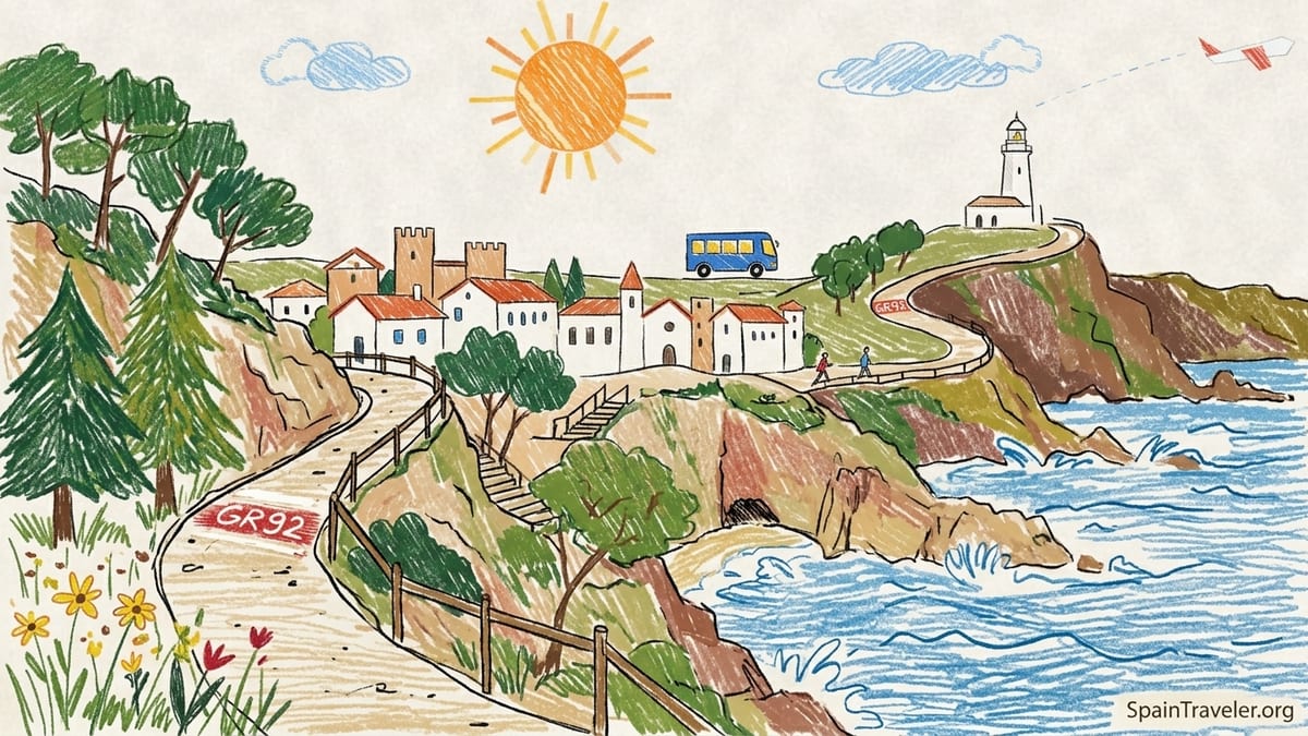
Understanding the Camí de Ronda and the GR92 Spine
On maps and tourism brochures, the Camí de Ronda looks like a single coastal line running almost the entire Costa Brava from Lloret de Mar toward Portbou. In reality, it is a patchwork of fishermen’s paths, old patrol tracks and modern promenades tied together by the red-and-white markings of the GR92, Spain’s Mediterranean long-distance route. The full coastal corridor between roughly Blanes or Lloret de Mar and the French border runs to around 190 kilometers, but very few walkers attempt all of it in one go. I joined it instead in bite-sized town-to-town sections where buses and accommodation made sense.
I built my walking days around three key stretches: Sant Feliu de Guíxols to Platja d’Aro via S’Agaró, Platja d’Aro to Sant Antoni de Calonge and Palamós, and the classic loop between Calella de Palafrugell, Llafranc and Tamariu, with a further continuation from Tamariu toward Aiguablava and Fornells. Each of these segments is under a full day in length, usually between 6 and 15 kilometers one way, and all of them are connected by the Moventis Sarfa bus network that shuttles along the coast between towns like Sant Feliu, Platja d’Aro, Palamós, Palafrugell and Begur. That bus map turned out to be almost as important as my trail map.
Before I set foot on the path, I knew from official GR92 descriptions that some stages gain around 100 to 200 meters of elevation over a day. In practice, what matters more is how those meters are delivered. On the Camí de Ronda they come in short, steep punches of stone steps between coves, rather than long gradual climbs. That means you can feel surprisingly worked after only 7 or 8 kilometers, especially in summer heat, even if the overall profile on paper looks tame.
For footwear I settled on breathable low-cut hiking shoes with grippy soles. Trail runners would also be fine on these sections since most of the surfaces are either stone, packed dirt or promenade paving. I saw plenty of people trying short bits in sandals or flip-flops between beach bars, but whenever the path narrowed to a rocky ledge or a flight of uneven old steps, I was glad I had something more serious underfoot.
Sant Feliu de Guíxols to S’Agaró and Platja d’Aro: A Gentle Introduction
My first real Camí de Ronda morning began at the harbor in Sant Feliu de Guíxols, a town that feels lived-in rather than purely seasonal resort. From the port I picked up the red-and-white GR92 flashes and followed the coast past Cala Jonca and Cala Vigatà. This opening section to Sant Pol beach is about 3 to 4 kilometers and gains roughly 100 meters overall, most of it in small, repeated climbs and descents. There are wooden staircases hugging rock walls, railings overlooking tiny coves and short shaded stretches through pine trees that offer a break from the sun.
By the time I reached the long arc of Platja de Sant Pol, the day had heated up. I started at 8:30 a.m. in late June, and by 10:00 the sand was already filling with families dragging coolers. Sant Pol makes a logical first swim stop. Lifeguards were on duty and the town behind the beach offered cafes for a coffee or second breakfast. I took a quick dip, changed under a towel and then walked the few hundred meters of seafront to the official start of the S’Agaró promenade, one of the most famous “easy” Camí de Ronda stretches.
The section between Sant Pol and Sa Conca beach is less than 2 kilometers, meticulously constructed and almost entirely paved, with balustrades, gazebos and villas peeking through umbrella pines. Despite the manicured feel, it still curves intimately around rocky points, with stone steps dipping down to micro-coves where locals were sunbathing on flat rocks. Shade comes and goes, and in the late morning light the white stonework seemed to bounce the heat up at me. Here the Camí de Ronda felt more like a historical garden walk than a wilderness trail, and it would be manageable for almost any reasonably mobile walker in sturdy sandals.
At Sa Conca I faced a decision: end with another swim and backtrack to Sant Feliu, or continue along the long open beach and press on toward Platja d’Aro. I chose to keep going and immediately felt the temperature shift. The sand and promenade from Sa Conca into Platja d’Aro, roughly another 3 kilometers, had almost no natural shade in the early afternoon. By the time I reached the wide main beach of Platja d’Aro the sun felt brutal. What had been advertised on paper as perhaps 9 to 10 kilometers of easy walking from Sant Feliu turned into a lesson in how exposed a coastal path can feel, especially in late June. I carried about 1.5 liters of water that day and finished it before I even crossed the town.
Platja d’Aro to Sant Antoni de Calonge and Palamós: Where I Underestimated the Route
The next morning I started in Platja d’Aro with the intention of “a relaxed seaside wander” to Sant Antoni de Calonge and maybe Palamós if I still felt fresh. On a map this looks like a comfortable day: approximately 8 to 10 kilometers from the central Platja d’Aro beach to the lighthouse above Palamós, depending on detours. The first kilometer and a half is an urban promenade, flat and straightforward. Once you leave the main beach behind, though, the Camí de Ronda resumes its traditional profile, and that is where I realized I had underestimated the route.
Between the southern end of Platja d’Aro and Sant Antoni de Calonge the path hops from cove to cove on a tight ribbon of stone stairs, tunnels and short ramps. Each individual climb is only 10 or 20 vertical meters, but they come in rapid succession. Wearing a small 20-liter daypack with water, a light towel and camera, I felt my heart rate ticking up regularly. There is some shade from pines leaning over the cliffs, but many of the staircases are fully exposed. I started around 9:30 a.m. and still found myself sidestepping into slivers of shade to sip from my bottle.
Scenically, this was one of the best sections I walked. Small coves like Cala Rovira, Cala Sa Cova and Cala del Pi offered crystalline water where I could see rocks and sea grass several meters down. At Cala del Pi a small hotel had a terrace overlooking the cove, and a handful of early bathers were swimming laps between buoys. I stashed my pack in the shade of a rock and took my first swim of the day. Getting into and out of the water required paying attention, since the access was by rocky steps and wet stone that could be slippery, another argument in favor of proper footwear.
By the time I reached Sant Antoni de Calonge, after about three hours of easy-going walking punctuated by photo and swim stops, the character of the route changed again. The coves give way to a broad sandy bay backed by an unbroken promenade that continues into Palamós. This is civilized coastal walking: flat, stroller-friendly, with benches, water fountains and a line of chiringuitos selling everything from espresso to seafood paella. I had a menu del día at a simple restaurant a block inland for around 16 euros, including a starter of fideuà, grilled fish and a drink. Lunch meant that my intended “relaxed seaside wander” had turned into more of a full-day outing.
Continuing to Palamós added another 3 to 4 kilometers of flat walking, but under the mid-afternoon sun it felt further. When I finally climbed the steps toward the lighthouse, my watch showed just under 14 kilometers for the day, and my legs felt it. This was the first time I explicitly thought, I should have started earlier. From Palamós, however, my car-free return was easy. There were several Moventis bus departures in the late afternoon back toward Platja d’Aro and Sant Feliu, with one-way tickets under 5 euros. The buses were air-conditioned but fairly full in late June, something to keep in mind if you plan to return after beach time.
Calella de Palafrugell, Llafranc and the Climb to the Lighthouse
Further north, I based myself in Palafrugell, a market town a short bus ride inland from the famous beaches. From there, local buses drop you at Calella de Palafrugell in about 10 minutes for around 2 euros. This cluster of low-rise white houses and tiled roofs feels exactly like the Costa Brava postcard you imagine before you arrive. My day here began with an easy stroll along the sea-level Camí de Ronda connecting Calella’s string of small beaches. Arches frame the water, fishing boats rest on the sand and the path holds almost no elevation for the first couple of kilometers as it swings toward Llafranc.
This stretch is short, and many people simply wander it in flip-flops between lunch spots and ice cream stands. Underneath that holiday mood, though, the path is still part of the GR92. In practical terms, this meant I could walk with a daypack containing just a liter of water and a light shirt, because re-supply points were never far away. In Calella I bought a bocadillo and fruit at a small supermarket for less than 8 euros and carried it for a picnic later. Even in high season, prices in inland Palafrugell the previous evening had been lower than directly on the seafront, so doing a small grocery run before heading to the beach made sense.
From Llafranc the tone of the route changes abruptly. To reach the Sant Sebastià lighthouse, an iconic high point along this part of the coast, the Camí de Ronda climbs steeply up a set of roads and paths. I counted several hundred steps, broken into a few distinct staircases. The total elevation gain is in the ballpark of 150 to 180 meters from sea level to the top. I took it slowly, pausing at shaded switchbacks to look back at the bay. This was one of the few times along the Camí de Ronda where I really wished for trekking poles, not because the path was technically difficult, but simply because the stair height and repetition wore on my knees.
At the top, the lighthouse area offers wide views north toward the more rugged coastline and south back over Llafranc and Calella. There is a hotel and restaurant next to the lighthouse, and on the day I passed a few cyclists were also resting here, having ridden up from Palafrugell. I ate my supermarket picnic on a low wall, grateful for both the view and the breeze. From here, walkers can continue on forest tracks inland, but my plan was to descend by a different combination of lanes and paths back toward Llafranc, completing a loop of around 8 to 9 kilometers with one serious climb.
From Tamariu Toward Aiguablava and Fornells: Short but Steep and Wild
If the S’Agaró segment is the Camí de Ronda at its most polished, the coastal path out of Tamariu shows it at its more rugged and intimate. I took a morning bus from Palafrugell to Tamariu, once again paying just a few euros and arriving in about 15 minutes. The village itself centers on a small, sheltered beach where cafes set tables right on the sand. In the early morning it felt half-asleep. I filled my bottle at a public fountain and set off along the southern edge of the bay where the GR92 and local waymarks lead up through the last line of houses.
The path from Tamariu toward Aigua Xelida, Aiguablava and Fornells is a constant negotiation between forest and rock. It quickly climbs away from sea level, gaining perhaps 100 meters in a series of irregular stone steps under pines before dipping again to cross small ravines. The total distance from Tamariu to Aiguablava by the most direct coastal variant is only several kilometers, but they are slow kilometers. Sections of the route are narrow, with roots and stones underfoot, and the heat builds quickly in the gullies where air does not circulate.
I carried 2 liters of water in a hydration bladder on this stretch and drank most of it by the time I saw the pale strip of Aiguablava beach below me. There are almost no services between the villages, so this was the one place along my Camí de Ronda days where running low on water would have been a real issue. I met only a handful of other walkers on this segment, mostly independent hikers with daypacks and trail shoes. Compared to the sociable feel of Calella and S’Agaró, Tamariu to Aiguablava felt genuinely like a trail.
My reward at the end was a long swim in the turquoise shallows of Platja d’Aiguablava, which lives up to its name with startlingly clear water. Here, for the first time that day, I saw package-tour visitors stepping off minibuses for a quick photo stop. Bars and restaurants crowd the back of the beach, and prices for drinks and snacks run higher than in Palafrugell. I paid about 4 euros for a coffee and a bottle of sparkling water at a beachfront bar, and I did not begrudge a cent of it. From Aiguablava it was a short walk up to the road where I could catch a bus back toward Begur or Palafrugell, completing a half-day loop that felt much longer than its distance suggested.
Managing Heat, Shade, Water and Footwear on the Coastal Paths
Across these different sections, the constant variables were heat, shade, stairs and my own tendency to underestimate “short” distances when the sea was sparkling. On paper, none of my days exceeded 15 kilometers. In reality, factors like start time, orientation of the coves and surface made the difference between a relaxed half-day and an unexpectedly taxing one. South-facing stretches around Platja d’Aro and Sant Antoni, for instance, were in full sun from mid-morning onward. North-facing coves near Tamariu held cool air longer but also trapped humidity.
My most successful days started early, on the trail between 7:30 and 8:00 a.m., especially in late June. This let me cover several kilometers of exposed promenade before the sun was high and reserve midday for swimming and lunch in shaded streets. On one of the days where I started closer to 10:00 a.m., I found myself slogging along the Platja d’Aro promenade in mid-afternoon, envying people already napping under umbrellas. That was the day I ended up drinking over 2 liters of water without ever needing a bathroom break, a clear sign of how much fluid the heat was drawing out of me.
For shade, the most consistently comfortable parts were the pine-covered headlands near Sant Feliu and some sections above Tamariu, where the forest canopy filtered the light and held a soft resin smell. Town promenades, despite their conveniences, were often the harshest because reflected heat from paving and buildings bounced upward. Even the beautiful S’Agaró path, with its cream-colored stone and low walls, acted a bit like an oven on still days. I learned to keep a light scarf and a cap in my daypack to protect my neck and face whenever the shade vanished.
Footwear and load made a noticeable difference too. A 20-liter pack with towel, water, snacks and a light fleece felt right at the start. On the Tamariu day, when I added an extra liter of water, a paperback and camera lens “just in case,” the pack crept toward uncomfortable. Most of the path is not technically demanding, but repeated steps both up and down put pressure on knees and ankles. I saw several people in fashion sneakers sliding on dusty stone and one person gingerly descending a staircase in leather sandals. My own low-cut hiking shoes, combined with thin wool socks, dried fast after getting splashed and gripped reliably on the frequent staircases.
Logistics Without a Car: Buses, Base Towns and Easy Exits
One of the reasons the Camí de Ronda works so well as a multi-day walking destination is the bus system that parallels much of the coast. From Barcelona, Moventis Sarfa coaches run to hubs like Sant Feliu de Guíxols, Platja d’Aro, Palamós, Palafrugell and Begur, with journey times between roughly 90 minutes and 3 hours depending on the route and stops. Once based in any of those towns, shorter local routes connect down to the coastal villages. Palafrugell, in particular, works well as a base for Calella, Llafranc, Tamariu and Aiguablava, while Sant Feliu or Platja d’Aro are practical for the southern segments I walked.
In practice, this meant I could walk one way along the coast and ride back most days. After finishing in Palamós, for example, I simply crossed from the seafront to the small bus station a few blocks inland and caught a late-afternoon departure back to Platja d’Aro and Sant Feliu. Tickets purchased on board were inexpensive and schedules, while not metro-frequent, were regular enough in late June that I never had to wait more than about an hour. The main exceptions were evening and Sunday services, which thin out, so checking the latest timetable posted at stops or on operator websites the day before made sense.
Base towns also influenced the character of my days. Sant Feliu de Guíxols felt like a working town with its own rhythm separate from beach tourism, which meant bakeries and cafes opened earlier and prices were slightly more grounded. Platja d’Aro, by contrast, has the feel of a dedicated resort, with a long strip of shops and restaurants that come alive later in the day and stay open into the night. Palafrugell offered the best of both worlds for the northern sections: an inland Catalan town with a central market and sensible grocery prices, but only a short bus hop from some of the most photogenic coves in the region.
Without a car, I did have to accept certain constraints. Late dinners by the sea sometimes meant walking back via a lit path to catch one of the last buses inland, or budgeting for a taxi when I chose to linger after dark. In exchange, I never once had to worry about parking, and I could finish walks with a glass of wine at lunch without thinking about driving. The GR92 markings themselves, red and white stripes painted on rocks and walls, were generally clear near the larger towns, though I did keep an offline map on my phone as a backup in more wooded sections like the hills above Tamariu.
The Sweet Spot: Scenery Versus Manageable Walking
Looking back over the days I spent weaving along the Costa Brava, certain sections stand out as the best balance between scenery and effort. If I had to recommend a single introductory day that almost any reasonably fit traveler could enjoy, it would be Sant Feliu de Guíxols to S’Agaró and on to Sa Conca, finishing with a swim and either walking back or catching a short bus. The stone path, arches and viewpoints deliver that quintessential blue-and-gold Mediterranean aesthetic with relatively modest elevation changes and plenty of escape options into town if someone in the group tires.
For walkers who want more of a workout without venturing into truly remote terrain, the combination of Platja d’Aro to Sant Antoni de Calonge and on to Palamós is hard to beat. The repeated stairs will remind your legs you are not simply on holiday, yet there is a cafe, beach or promenade never far away. You can bail out at several points by heading inland a few blocks to the main road and catching a bus. This was the day I underestimated most, partly because the map looked so civilized. By the evening, with around 14 kilometers and dozens of staircases behind me, I understood why seasoned hikers often say that “coastal flat” is a deception.
For hikers seeking something wilder within a half-day’s walk, Tamariu to Aiguablava is the obvious candidate. The distance is short enough for most people to manage with time for swimming, but the terrain and lack of on-route services demand a touch more preparation. Here, the scenery upgrades from lovely to dramatic, with cliffs, deep inlets and pine forest smells that stay with you long after you board the bus back to your base. If I return, I will plan a full day that extends past Aiguablava through Fornells and onward toward Begur, accepting more climbing in exchange for more of that broken, rugged coastline.
In the end, the Camí de Ronda taught me that Costa Brava’s defining experience is not any single famous beach or viewpoint. It is the act of moving between them on foot, watching how the character of the coast shifts from polished promenade to fishermen’s steps and back again. I did underestimate parts of it, especially in terms of heat and repetitive climbing, but those surprises were part of the appeal. The trail is forgiving enough that you can adjust on the fly, resurface into a town when needed and rejoin it again the next morning with a better sense of respect.
FAQ
Q1. How difficult are the Camí de Ronda sections between Sant Feliu, S’Agaró and Platja d’Aro?
The walks between Sant Feliu, S’Agaró and Platja d’Aro are generally easy to moderate, with frequent short stair climbs rather than long ascents, and plenty of exit points into nearby towns.
Q2. Do I need hiking boots, or are sneakers enough on the Costa Brava coastal paths?
Sturdy sneakers or low-cut hiking shoes with good grip are usually enough, but open sandals or flip-flops feel unsafe on the stone steps and rockier sections between coves.
Q3. Is it realistic to hike the Camí de Ronda without a rental car?
Yes, the Moventis Sarfa bus network connects main towns like Sant Feliu, Platja d’Aro, Palamós, Palafrugell and Begur, so you can walk one way and return by bus most days.
Q4. How much water should I carry for a half-day on the trail in summer?
For a 3 to 5 hour walk in warm weather, carrying at least 1.5 to 2 liters per person is wise, especially on wilder stretches like Tamariu to Aiguablava where there are no shops.
Q5. Which section offers the best combination of views and manageable effort for beginners?
The route from Sant Feliu de Guíxols to S’Agaró and Sa Conca is an ideal starter section, with beautiful viewpoints, modest elevation and easy access to cafes and buses.
Q6. Are there many places to swim directly from the Camí de Ronda?
Yes, numerous coves such as Cala del Pi, Sant Pol, Sa Conca, Calella de Palafrugell and Aiguablava are directly on the path, often with signed stair access to the water.
Q7. When is the best time of day to hike to avoid the worst heat?
Starting early, between 7:30 and 8:30 a.m., lets you cover exposed promenades before midday; afternoons on open sections like Platja d’Aro can feel extremely hot in summer.
Q8. Can families with children manage the coastal paths described here?
Families with active children often enjoy the shorter, paved parts around S’Agaró and Calella, but parents should watch kids closely on staircases and cliff-edge viewpoints.
Q9. How clearly marked is the GR92 along the Costa Brava?
Most of the GR92 along these sections is marked with red-and-white paint flashes, especially near towns, though having an offline map helps in wooded or less-built-up stretches.
Q10. Do I need to book accommodation in advance when planning Camí de Ronda walks?
In high season it is safer to reserve rooms in hubs like Sant Feliu, Platja d’Aro, Palafrugell or Begur a few weeks ahead, as coastal villages can fill quickly with holiday visitors.